Beskidek Pass
6.48
Overview
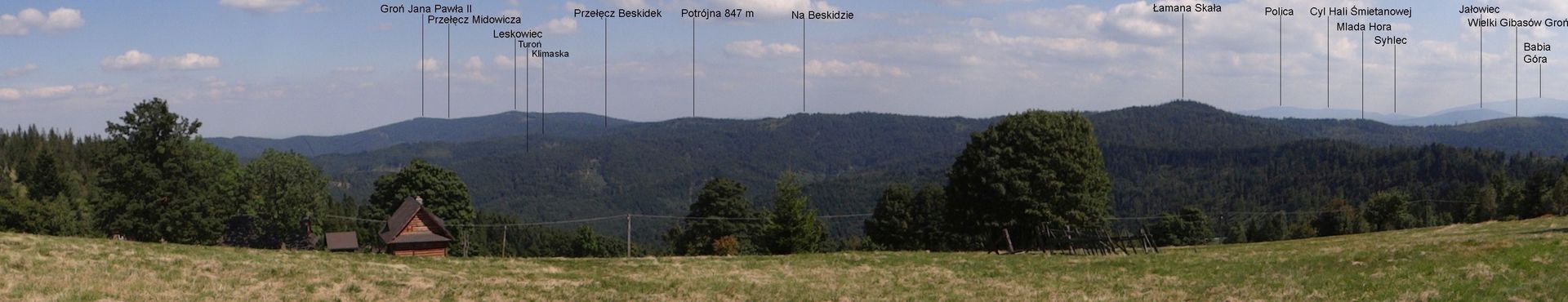
Beskidek Pass, situated at an altitude of 799 meters above sea level in the Łamana Skała Range of the Little Beskids, is a picturesque location nestled between the peaks of Leskowiec (922 m) and Potrójna (847 m). It is characterized by the complete forestation of its northwestern and southeastern slopes, which descend into the valleys of the Klimaska and Sikorówka streams, respectively. Administratively, the pass forms the border between the villages of Rzyki in Wadowice County and Krzeszów in Sucha County, both within the Małopolskie Voivodeship.
Over time, Beskidek has witnessed several significant events related to the development of transportation in the region. Until the end of the 19th century, it served as a route connecting Andrychów with Ślemień, and there were plans to build an asphalt road between Andrychów and Sucha Beskidzka. Today, the pass is a popular hiking destination, traversed by two tourist trails: the Mały Szlak Beskidzki (Little Beskids Trail) and another trail leading through Gołasie to Góra Potrójna. The hiking time from Smrekowica to Leskowiec is approximately 3 to 3.5 hours, making it accessible to hikers of various experience levels.
Thanks to its lush forest cover, Beskidek offers an immersive experience in nature, with stunning views of the surrounding peaks and a rich diversity of flora and fauna. This makes it a destination well worth visiting.
Location
2026 Wizytor | All Rights Reserved