Biała Piska
7.04
Overview
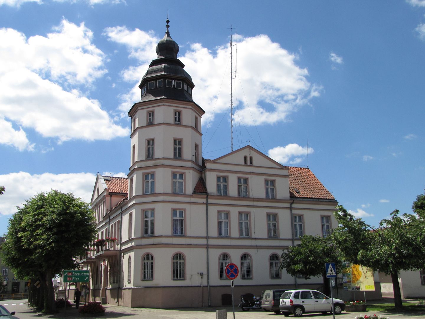
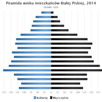
Biała Piska is an urban-rural municipality in the Warmian-Masurian Voivodeship, within Pisz County, with its administrative seat located in Biała Piska. The origins of the town date back to 1482, when it was founded on the Gayle stream. In the 14th century, these lands were settled by Polish colonists, and thanks to its favorable location on a trade route, the municipality gained importance, particularly through the organization of cattle fairs. In 1722, Biała Piska was granted town rights, and its population at that time was approximately 600. The municipality covers an area of 420.14 km², of which 50% is agricultural land and 40% is forested. The population has undergone some demographic changes – in 2004, it numbered 12,287, and by the end of 2019, it had decreased to 11,622. The municipality is home to numerous protected areas, including the Dybowski Hills Landscape Park, the Orzysz Lakes, and the Pisz Forest and Lakes. There are also areas covered by the NATURA 2000 network, specifically the Orzysz Military Range Refuge, and the Zdedy Lake Bird Sanctuary ecological site. In terms of architecture, the municipality boasts landmarks such as a water tower, a railway station building from the turn of the 19th and 20th centuries, and the parish church of Saint Andrew Bobola, built between 1756 and 1763 and designed by the renowned architect Karl Friedrich Schinkel. The municipality borders towns such as Ełk, Grabowo, Kolno, Orzysz, Pisz, Prostki, and Szczuczyn, underscoring its local significance in the region. Interestingly, despite its small population, Biała Piska preserves rich cultural and historical traditions tied to the development of trade and settlement in earlier times.
Location
You can also find here:
2026 Wizytor | All Rights Reserved