Gostynin
7.04
Overview
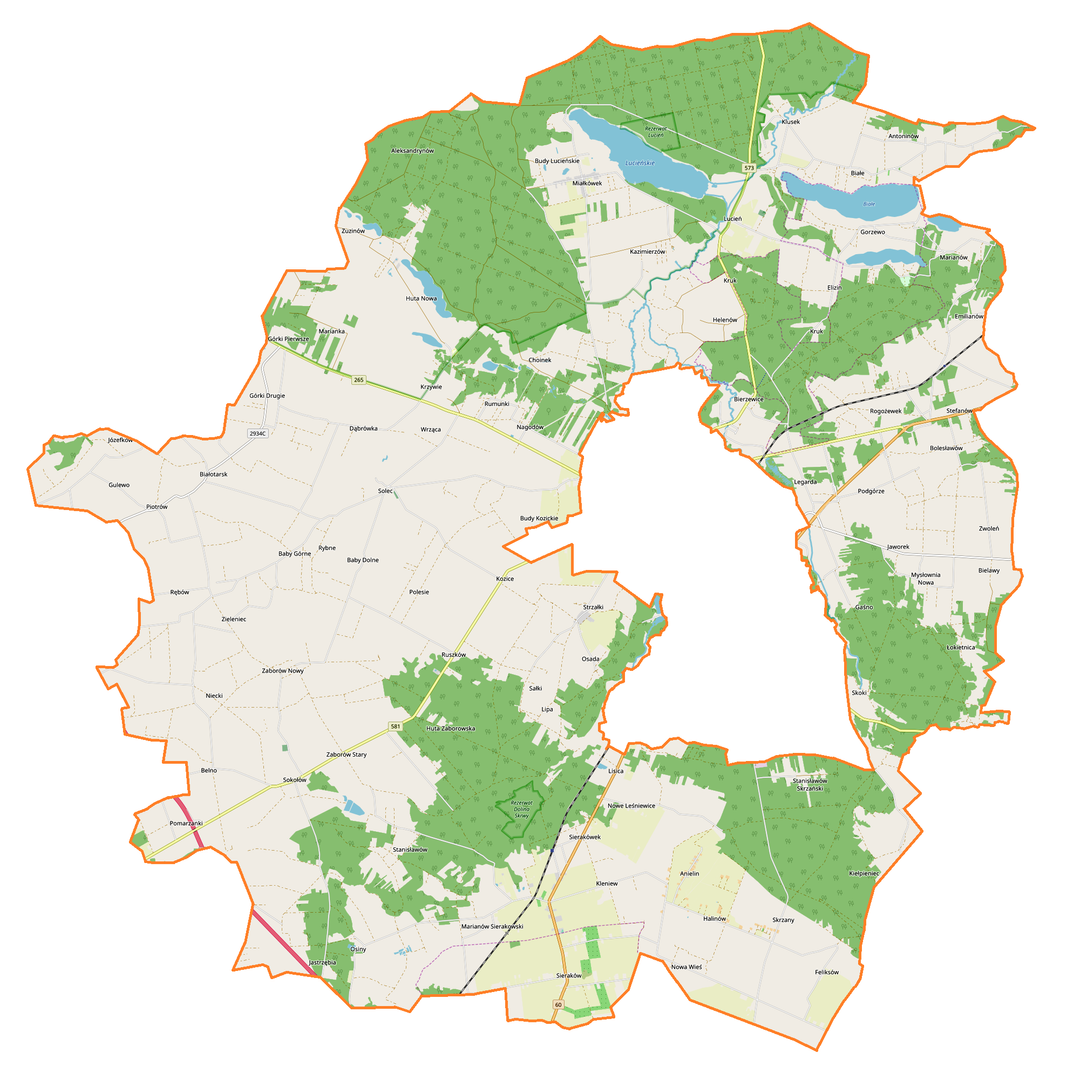
Gmina Gostynin, located in the Masovian Voivodeship within Gostynin County, is an area rich in history and characterized by a diverse demographic structure. As of December 31, 2012, the municipality was inhabited by 12,185 residents, and according to data from 2017, this number stood at 12,121 people. In the past, prior to the administrative reform of 1988, the municipality consisted of two separate units: Rataje and Gostynin. Covering an area of 270.69 km², the municipality is primarily agricultural and forested, with farmland accounting for 62% and forests for 28% of its territory. Gostynin serves as the administrative seat of the municipality, which includes numerous villages such as Anielin, Białotarsk, Gorzewo, and Zwoleń. The area of the municipality constitutes 43.97% of the total area of Gostynin County. Gmina Gostynin not only boasts natural beauty but also takes pride in its rich cultural heritage. Notable features include preserved elements of rural architecture that reflect historical building traditions. The region also hosts various cultural events that attract both residents and tourists, promoting local traditions and customs. An interesting fact is that from 1975 to 1998, the municipality administratively belonged to the Płock Voivodeship, reflecting the changing administrative landscape of Poland. Neighboring municipalities, such as Baruchowo, Lubień Kujawski, and Łanięta, form a diverse area that fosters cooperation and cultural exchange. Gmina Gostynin, with its rich history and dynamically evolving social life, is a significant part of the Masovian landscape.
Location
You can also find here:
2026 Wizytor | All Rights Reserved