Kobyla Mountain
6.46
Overview
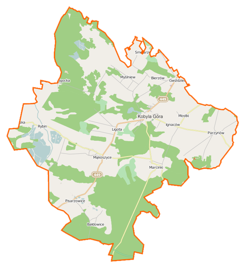
Kobyla Góra is a rural municipality located in the Greater Poland Voivodeship, within Ostrzeszów County, with its administrative seat in the town of the same name. From 1975 to 1998, the municipality was part of the Kalisz Voivodeship. In 2016, it covered an area of 129.2 km² and had a population of 6,178, accounting for 11.2% of the county's population. Land use is predominantly forest (44.7%) and agricultural (34.4%), with the region characterized by low soil quality, which hinders agricultural development in favor of animal husbandry and tourism. The municipality lies within the protected landscape area of "Wzgórza Ostrzeszowskie i Kotlina Odolanowska," and its highest point is Kobyla Góra, reaching 284 meters above sea level.
The history of the region dates back to the late 14th century when Kobyla Góra developed into a settlement with established infrastructure. In the 15th century, mills and crafts, including pottery, emerged, and in 1509, it was granted the privilege to organize fairs. After the loss of Poland's independence and the partitions, Kobyla Góra lost its town status in 1793 and remained a village. In 1860, a road connecting Ostrzeszów and Syców was built, improving transportation. Local community life was significantly influenced by events related to the Spring of Nations and the merger of two villages—Kobyla Góra and Góra—in 1934.
Kobyla Góra features valuable historical monuments, such as the Parish Church of St. Hedwig from 1808, the Evangelical Church from 1894, and the historic church in Myślniew from 1746. The municipality consists of several villages, including Bałdowice, Bierzów, and Pisarzowice, and borders other municipalities, fostering local integration and cultural exchange. An interesting fact is that despite its small size, Kobyla Góra played an important historical role as a trading center due to its location on the route from Kalisz to Wrocław.
Location
2026 Wizytor | All Rights Reserved