Lublin Island
6.14
Overview
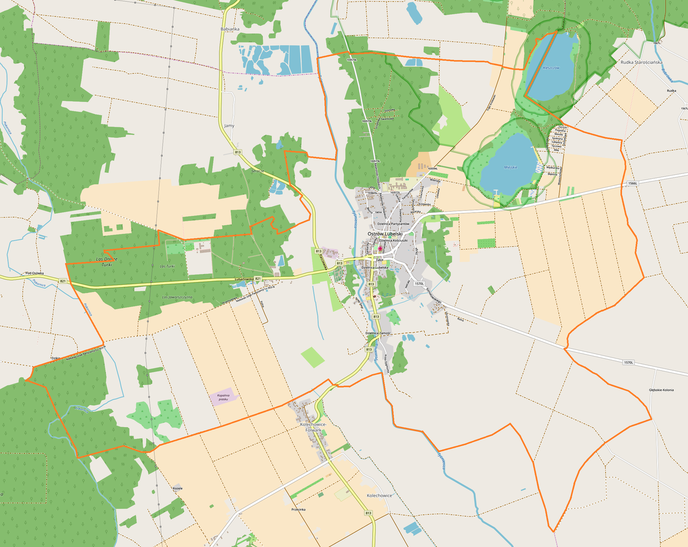
Ostrów Lubelski is a town located in the northern part of the Lublin Voivodeship, within the Lubartów County, boasting a rich history and architecture. It lies on the Tyśmienica River and is surrounded by the picturesque landscape of the Łęczna-Włodawa Lakeland. Within the town's boundaries lies Jezioro Miejskie (Town Lake), which, with an area of 49.5 hectares, is an important element of the local nature. The history of Ostrów dates back to the 15th century when the village was first mentioned in 1441. Ostrów received town rights in 1548, which contributed to its development. In the 18th and 19th centuries, the town was a center for crafts, including brewing and tailoring. Between 1914 and 1920, the town underwent numerous administrative changes; after the destruction during World War I, the inhabitants applied for the restoration of town rights, which took place in 1919. Tragic events occurred during World War II when the majority of the Jewish population was lost in the Holocaust, and the town became a center of partisan activity. After the war, Ostrów Lubelski was awarded the Order of the Grunwald Cross, 3rd Class, for outstanding merits in the fight against the occupier. It is worth noting the monuments, such as the Church of the Immaculate Conception of the Blessed Virgin Mary and late Baroque chapels, which testify to a rich architectural tradition. Ostrów has favorable conditions for the development of tourism, and the local economy is based on agricultural and food processing. Communication with other cities is provided by bus connections and the proximity of railway stations and airports. The education system is represented by a municipal kindergarten, Jan Paweł II Primary School, and the School Complex in Ostrów Lubelski. An interesting fact is the town's location as one of the least densely populated in Poland, which emphasizes its intimate character. Ostrów Lubelski, with its history, natural and cultural assets, is an important point on the regional map.
Location
2026 Wizytor | All Rights Reserved