Panki
6.12
Overview
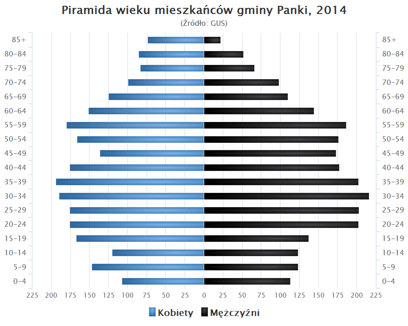
The municipality of Panki, located in the northwestern part of the Silesian Voivodeship, covers an area of 54.94 km², of which 59% is agricultural land and 33% is forested land. It constitutes 6.19% of the area of Kłobuck County. Its shape resembles a rectangle with its longer axis oriented north-south. Between 1975 and 1998, the municipality belonged to the Częstochowa Voivodeship, and its seat is the town of Panki at 5 Tysiąclecia Street. Neighboring municipalities include Krzepice, Opatów, Przystajń, and Wręczyca Wielka. The area lies within the Silesian-Kraków Upland Subprovince, in the macroregion known as the Woźniki-Wieluń Upland, which gives it a diverse landscape topography. The municipality of Panki is nourished by the Liswarta River and its tributary, the Pankówka River, which influence the local hydrography. Demographically, the municipality has a varied age distribution among its residents, as seen in the 2014 population pyramid. Panki is rich in historical agricultural and forestry traditions, which are reflected in its architecture and spatial structure typical of rural areas, with characteristic farm and residential buildings often maintained in a local style. An interesting fact is that the municipality of Panki frequently organizes cultural events that promote local traditions and bring the community together, creating a space for sharing experiences and cultural inspiration.
Location
2026 Wizytor | All Rights Reserved