Radziłów
6.75
Overview
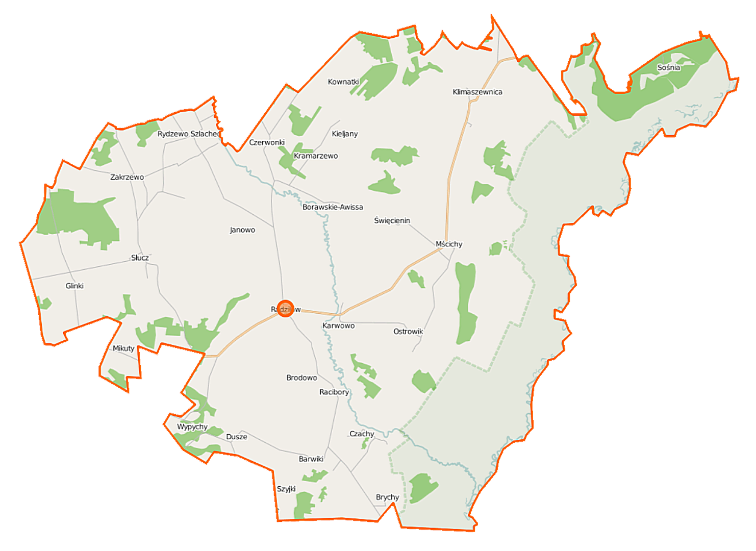
Radziłów is a rural commune (gmina) located in the Podlaskie Voivodeship, within Grajewo County, with its administrative seat in the village of Radziłów. The commune has a rich history dating back to the times of the Kingdom of Poland. It was established on May 31, 1870, following the loss of town rights by the town of Radziłów, which was then transformed into a rural commune. Between 1975 and 1998, the commune belonged to the Łomża Voivodeship. As of June 30, 2004, the population of the commune was 5,142. The total area of the commune is 199.38 km², of which 70% is agricultural land and 9% is forested. The commune of Radziłów consists of 30 village administrative districts (sołectwa), including Barwiki, Czerwonki, Janowo, and Radziłów, which is divided into Radziłów I and Radziłów II. The commune also includes non-administrative villages such as Borawskie-Awissa-Kolonia and Radziłów-Kolonia. Radziłów is surrounded by the communes of Goniądz, Grajewo, Jedwabne, Przytuły, Trzcianne, and Wąsosz. The region is characterized by charming landscapes and rich natural resources. As a traditional agricultural area, the commune has unique cultural features that reflect local customs and traditions. Combining elements of history and culture, Radziłów serves as an interesting example of a Polish rural community, with a strong emphasis on preserving local traditions and the creativity of its inhabitants.
Location
You can also find here:
2026 Wizytor | All Rights Reserved