Rozogi
6.6
Overview
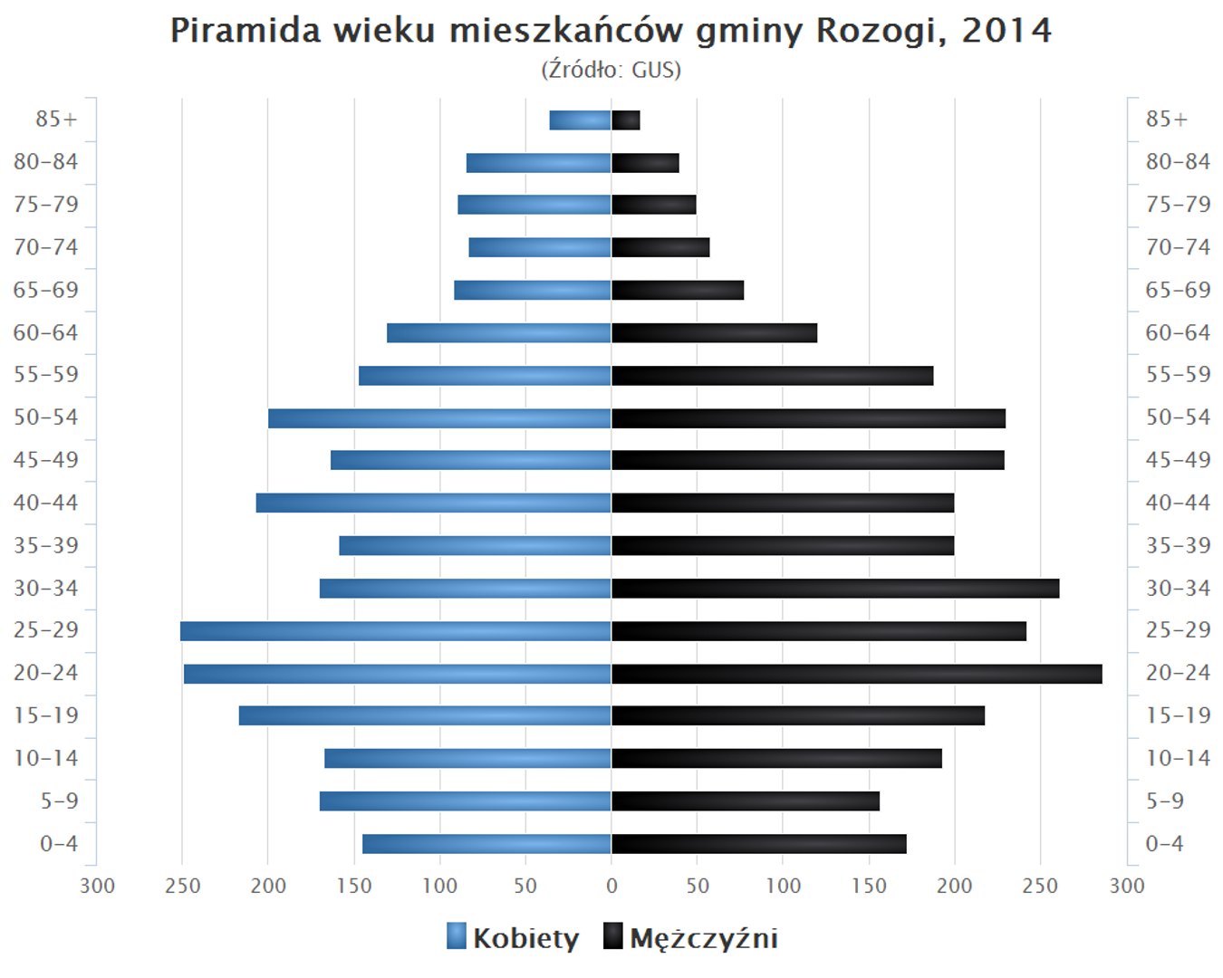
The Rozogi Commune, located in the Warmian-Masurian Voivodeship within the Szczytno County, is an area rich in natural beauty and history. Its administrative seat is in the village of Rozogi. Between 1975 and 1998, the commune was part of the Ostrołęka Voivodeship. In 2004, it was inhabited by 5,612 people, and by the end of 2019, this number had slightly decreased to 5,523. The commune lies within the Green Lungs of Poland region and along the Warsaw–Masuria transport route, making it an attractive location. Rozogi is surrounded by several communes, including Świętajno, Ruciane-Nida, and Pisz, as well as Kurpie communes from the Masovian Voivodeship. The commune covers an area of 223.95 km², of which 53% is agricultural land and 41% is forest, highlighting its natural diversity. The commune's structure includes numerous village administrations (sołectwa), such as Borki Rozowskie, Faryny, and Rozogi, along with smaller settlements that contribute to its local character. The region is known for its rich culture, with traditions tied to agriculture and forestry, and residents actively preserve local customs and folklore. An interesting fact is that the commune lies at the border of two cultures: Masurian and Kurpie, which influences the diversity of regional traditions and language. The Rozogi Commune is a place where nature meets history, offering both residents and visitors unique experiences of the Polish countryside.
Location
You can also find here:
2026 Wizytor | All Rights Reserved