Żółkiewka
6.49
Overview
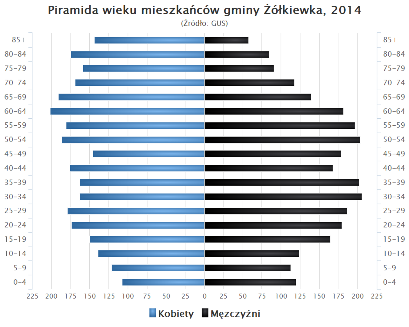
Żółkiewka is a rural commune located in the Lublin Voivodeship, within the Krasnystaw County, with its seat in the town of Żółkiewka. Between 1975 and 1998, the commune was part of the Zamość Voivodeship. The history of the commune dates back to the times of the Kingdom of Poland, when it belonged to the Krasnystaw County in the Lublin Governorate. In 1870, Żółkiewka, which had lost its town rights, was incorporated into the commune. The commune covers an area of 130.01 km², with agricultural land dominating, accounting for 85% of the area. According to data from June 30, 2004, the commune was inhabited by 6,220 people, and an analysis of the age pyramid was conducted at that time. Żółkiewka is home to several educational institutions, including primary schools, a middle school, and a secondary school complex, demonstrating the community's commitment to education. Architecturally, the commune does not stand out in the region, but traditional rural buildings and historical monuments may attract attention. An interesting fact is that the commune constitutes 11.43% of the area of Krasnystaw County. Żółkiewka borders communes such as Gorzków, Krzczonów, Rudnik, Rybczewice, Turobin, and Wysokie, which creates opportunities for local cooperation and cultural exchange. The localities within the commune are diverse, including villages like Adamówka, Chłaniów, or Wierzchowina, as well as non-administrative settlements, such as Borówek-Kolonia. Local traditions and cultural events are an interesting aspect and a significant element of the community's identity. Despite its rural character, the Żółkiewka Commune can boast a rich history and a diverse social and educational structure.
Location
You can also find here:

2026 Wizytor | All Rights Reserved