Brzesko
6.49
Overview
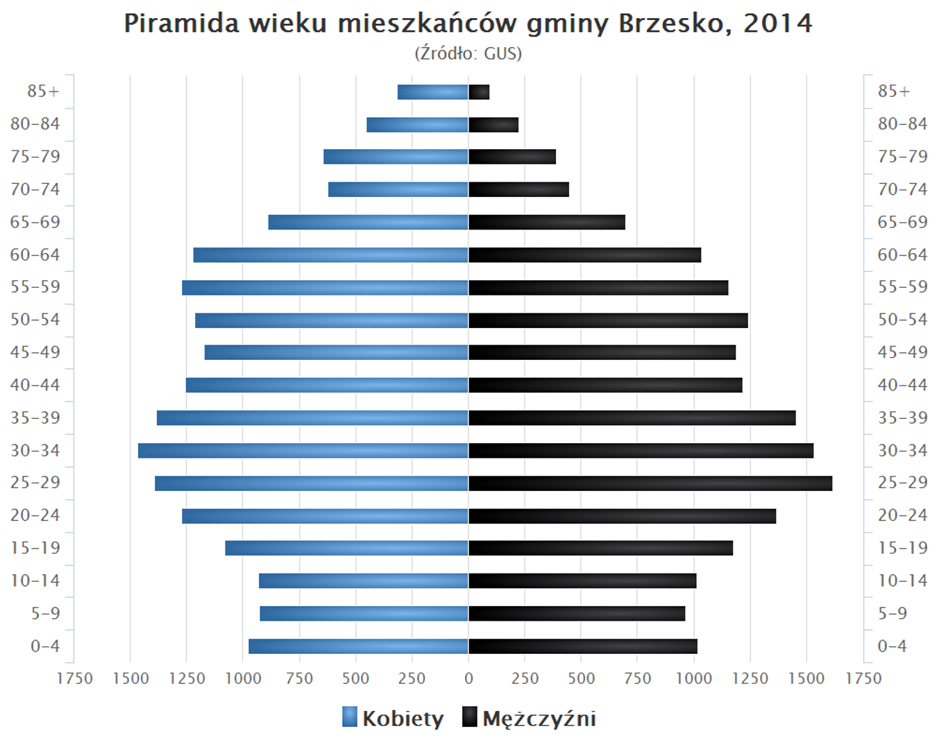
The Brzesko municipality, located in the Lesser Poland Voivodeship, covers an area of 102.57 km², where agricultural land (67%) and forests (18%) dominate. Between 1975 and 1998, the municipality was part of the Tarnów Voivodeship and is also known as the seat of its local administration. In 2009, Brzesko became the coordinator of the "Słoneczna Małopolska" (Sunny Lesser Poland) project, which aimed to secure funding for the installation of solar energy systems in households. In terms of religious life, the municipality is home to 8 Roman Catholic parishes and one congregation of the Church of God. Demographic data from 2008, which can be used for age pyramid analysis, were also recorded. The municipality is divided into village administrative units (sołectwa), corresponding to villages such as Bucze, Jadowniki, and Mokrzyska, as well as urban settlements like Kopaliny-Jagiełły and Stare Miasto. Brzesko borders other municipalities, such as Bochnia and Dębno, fostering regional cooperation. Architecturally, Brzesko blends elements of traditional Polish rural buildings with modern initiatives, such as renewable energy projects, making it an interesting example of harmonious local community development.
Location


2026 Wizytor | All Rights Reserved