Dygowo
7.35
Overview
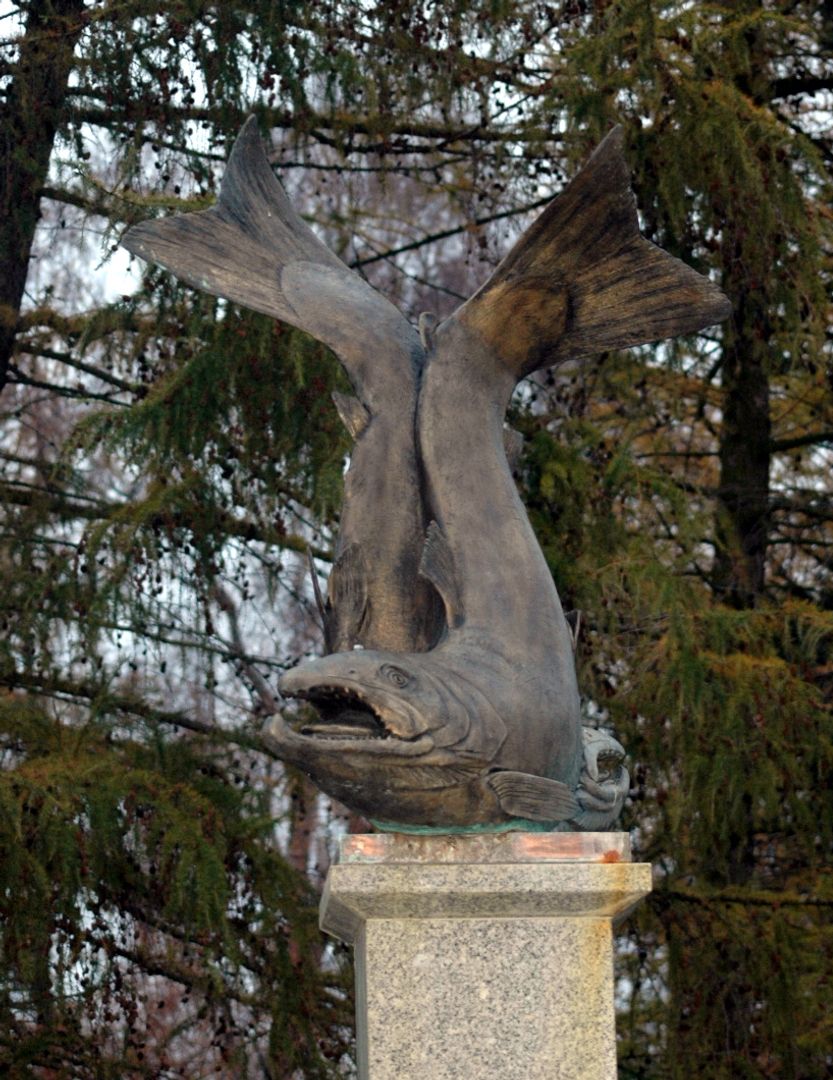
The Dygowo Commune is a rural administrative unit located in northwestern Poland, in the West Pomeranian Voivodeship, with its seat in the village of Dygowo. The commune covers an area of 128.52 km² and, according to data from 2016, is inhabited by 5,646 residents. The symbol of the commune is the king salmon, visible in its coat of arms and in the form of a monument-fountain in Wolności Square in Dygowo, reflecting the local resources of the Parsęta River. The commune is primarily agricultural, with 71% of its area dedicated to farmland. The interesting terrain includes a range of hills and uplands, with the highest elevation reaching 46 meters above sea level. The names of localities, such as Bardy or Czernin, conceal a rich historical heritage; in Czernin, there is a Gothic church from the 14th century, and in Dygowo, a Neo-Romanesque church from 1880. Many houses and structures, such as timber-framed cottages, date back to the 19th century, serving as testaments to local architecture. The Dygowo Commune is also a hub for tourist activities, with hiking trails, including the Salt Trail. Within the commune, 20 natural monuments are registered, showcasing its rich ecosystem, including the Stramniczka Nature Reserve. The commune contains parts of oil and natural gas deposits, highlighting its resource potential. In addition to natural attractions, the region is characterized by a Baltic climate, with mild winters and cool summers. The Dygowo Commune pursues an active local government policy, with 15 village councils and various local initiatives. An interesting fact is that the commune collaborates with neighboring units on infrastructure and tourism development. Moreover, Dygowo benefits from historical traces of settlement, such as medieval cemeteries, making it an interesting point on the historical map of Pomerania.
Location
You can also find here:
2026 Wizytor | All Rights Reserved