Gorlice
6.39
Overview
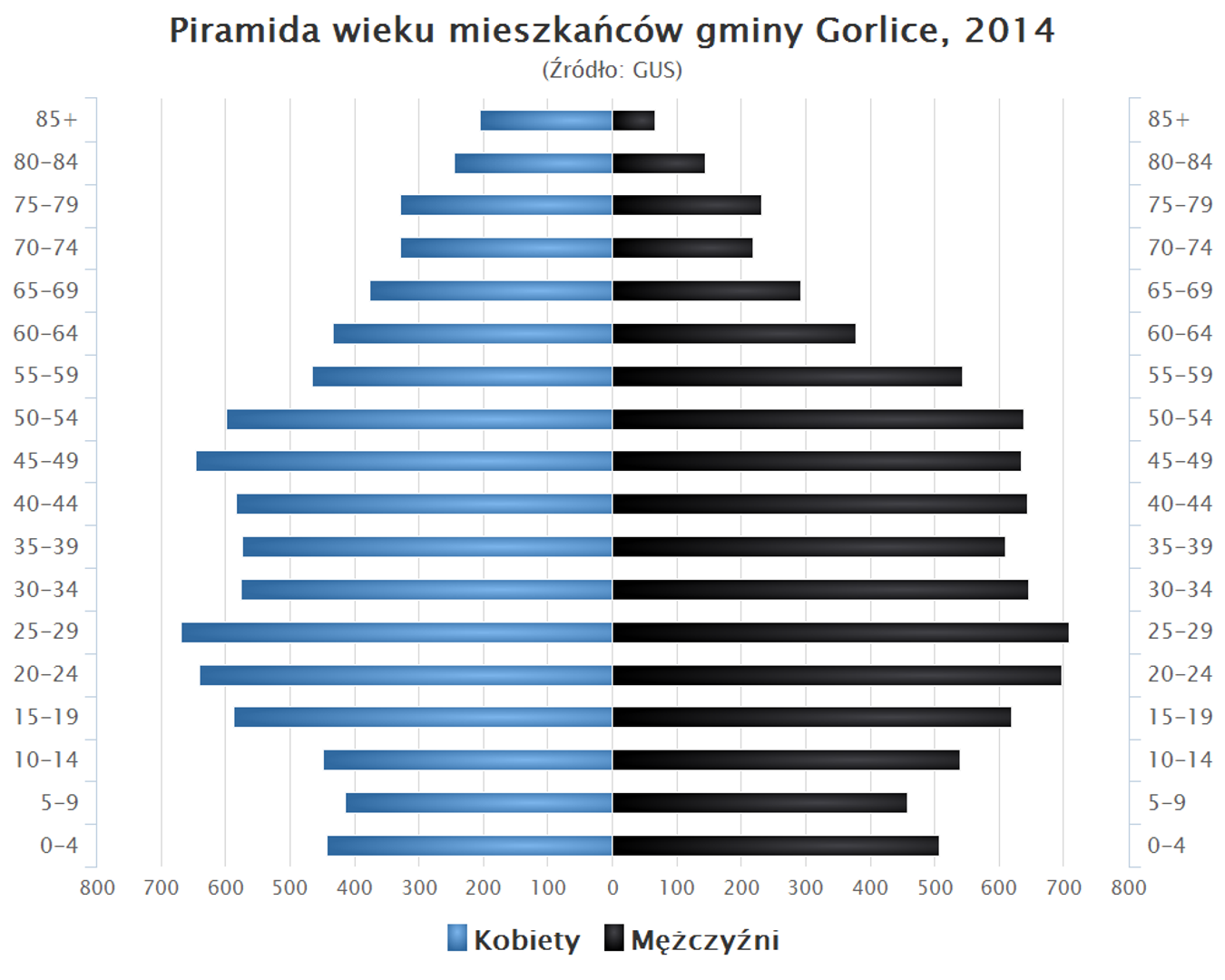
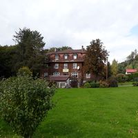
The Gorlice Commune, located in the Lesser Poland Voivodeship within Gorlice County, covers an area of 103.43 km², of which 62% is agricultural land and 30% is forested land. This commune, which is also part of the county, does not include the town of Gorlice, which holds the status of an urban municipality. Historically, between 1975 and 1998, the commune was part of the Nowy Sącz Voivodeship. The Gorlice Commune consists of several villages, including Bielanka, Bystra, Dominikowice, Klęczany, Kobylanka, Kwiatonowice, Ropica Polska, Stróżówka, Szymbark, and Zagórzany. The demographic structure is noteworthy and has been the subject of analysis, particularly in the context of the age pyramid of residents in 2014, which illustrates population changes and demographic trends. The commune borders other municipalities, such as Biecz and Grybów, fostering regional cooperation and support for local initiatives. Architecturally, the area is characterized by traditional rural buildings and historically significant structures, reflecting the region's rich culture and history. An interesting fact is that the history of the commune dates back to pre-war times, and its development has been closely linked to various social and economic transformations. In terms of its structure and rich heritage, the Gorlice Commune is a significant point on the map of Lesser Poland, offering not only architectural but also cultural attractions that draw tourists and residents alike.
Location
2026 Wizytor | All Rights Reserved