Przasnysz
6.96
Overview
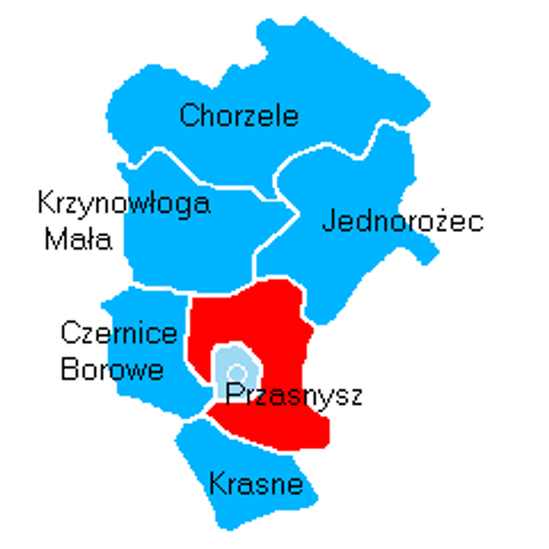
The Przasnysz Commune, located in the Masovian Voivodeship, covers an area of 183.91 km², of which 78% is agricultural land and 16% is forest land. With its seat in the town of Przasnysz, the commune is part of Przasnysz County and was home to 7,189 people in 2004. It is a rural commune that, prior to 1998, belonged to the Ostrołęka Voivodeship. The presence of the Przasnysz-Sierakowo landing strip within its territory highlights the importance of air transport in the region. The commune is surrounded by other administrative units, such as Czernice Borowe, Jednorożec, Krasne, Krzynowłoga Mała, and Płoniawy-Bramura. Numerous villages are registered within the commune, including Bartniki, Bogate, Cierpigórz, Dębiny, and others. An interesting fact is that the Przasnysz Commune, formerly part of the Karwacz Commune, has its own unique history dating far into the past. Localities such as Annopol and Frankowo, as well as lesser-known ones like Józefowo or Kuskowo, add to the diversity of the commune. In 2014, an age pyramid of the inhabitants was presented, allowing for the tracking of demographic changes in the area. The commune can boast a rich cultural and architectural heritage, elements of which are often tied to rural lifestyles and local traditions.
Location
2026 Wizytor | All Rights Reserved