Tarczyn
7.04
Overview
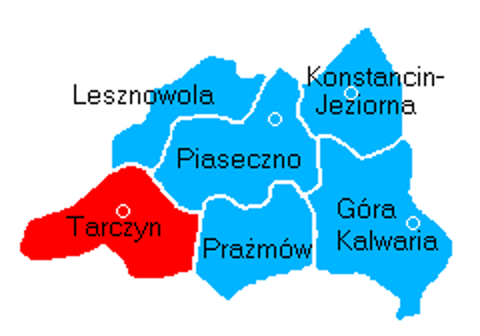
The municipality of Tarczyn, located in the Masovian Voivodeship within the Piaseczno County, is an urban-rural municipality with its seat in the town of Tarczyn. The area of the municipality is 114.15 km², of which 75% is agricultural land and 14% is forest land. Tarczyn borders six municipalities: Żabia Wola, Nadarzyn, Lesznowola, Piaseczno, Prażmów, and Grójec, with the Jeziorka River forming its natural eastern boundary. The municipality is situated at the border of the Łowicz-Błonie Plain, the Warsaw Plain, and the Rawa Upland, with parts of its territory lying within the Warsaw Protected Landscape Area and the Chojnów Landscape Park. Demographically, in 2017, the municipality was home to 11,415 people, and by 2019, this number had increased to 11,567. Tarczyn is home to several schools, including the Irena Sendlerowa Public High School and the Szare Szeregi School Complex, reflecting the area's commitment to education. Additionally, the municipality boasts a rich network of villages, such as Borowiec, Gąski, Komorniki, and Wola Przypkowska, among others, which add local charm. It is also worth noting the local media outlets, such as powiat-piaseczynski.info and Piaseczno Sport News, which keep residents informed about events and activities in the region. With its rich history and picturesque landscapes, Tarczyn is an interesting point on the map of Masovia, blending tradition with modernity.
Location
You can also find here:
2026 Wizytor | All Rights Reserved