Boguchwała
6.25
Overview
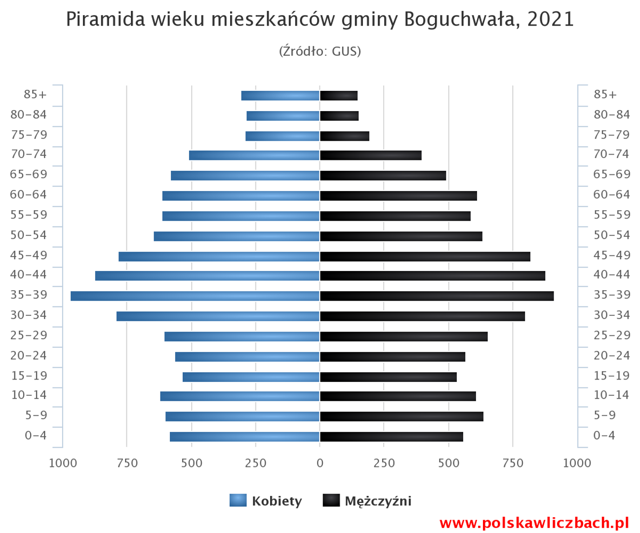
Boguchwała is an urban-rural municipality located in the Podkarpackie Voivodeship, within Rzeszów County, with its administrative seat in Boguchwała. According to data from the end of 2022, it has a population of 21,893. The municipality boasts a rich history, being one of the administrative units established during the Austrian Partition. In the interwar period, Boguchwała functioned as a single-village rural municipality and on August 1, 1934, it became part of the collective municipality of Racławówka. Following administrative reforms in the 1950s, it became the seat of a national council commune (gromada), encompassing nearby localities. In 1973, it gained the status of a collective municipality, and in 2008, it was transformed into an urban-rural municipality. The municipality covers an area of 96.19 km², of which 81% is agricultural land and 11% is forested, making it an industrial-agricultural commune. A key element of its infrastructure is National Road No. 19, which connects it with other regions. The municipality includes villages such as Kielanówka, Lutoryż, Mogielnica, Niechobrz, Nosówka, Racławówka, Wola Zgłobieńska, Zarzecze, and Zgłobień. Boguchwała is surrounded by neighboring municipalities: Czudec, Iwierzyce, Lubenia, Rzeszów, and Świlcza, which influences its transport and cultural development. With its history and diversity, the Boguchwała municipality is an interesting microregion of Podkarpacie, blending elements of agricultural tradition with modernity.
Location
You can also find here:
2026 Wizytor | All Rights Reserved