Ruda-Huta
6.11
Overview
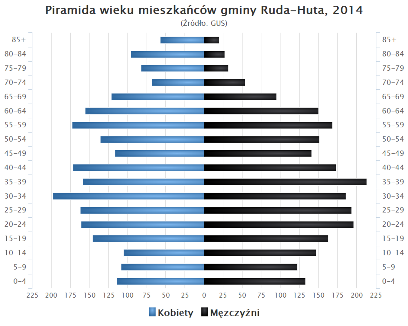
Gmina Ruda-Huta, located in the Lublin Voivodeship, Chełm County, is an area with a rich demographic and natural structure. Its administrative seat is the town of Ruda-Huta. Historically, between 1975 and 1998, the municipality was part of the Chełm Voivodeship. Within the gmina lies the important Bagno Serebryskie Nature Reserve, which protects a unique carbonate peatland that serves as a habitat for rare species of birds and plants. The municipality covers an area of 112.48 km², of which 73% is agricultural land and 17% is forested, highlighting its agricultural and woodland character. Demographically, in 2009, the gmina was inhabited by 4,831 people, which decreased to 4,794 by 2011. The gmina consists of numerous village administrations (sołectwa), such as Chromówka, Dobryłów, Gdola, and Hniszów, as well as non-administrative villages including Hniszów-Kolonia and Ruda-Kolonia. Additionally, Ruda-Huta borders municipalities such as Chełm, Dorohusk, and Sawin, as well as Ukraine, which may influence its cultural and economic exchanges. The gmina also stands out for its interesting population age pyramid. It is worth noting that its location near the border with Ukraine is associated with a rich history and potential cultural influences from both sides of the border. Thus, Gmina Ruda-Huta is a place with a multi-layered history, fascinating natural resources, and local traditions that have shaped the unique character of this community over the years.
Location
You can also find here:

2026 Wizytor | All Rights Reserved