Stąporków
7.3

Overview
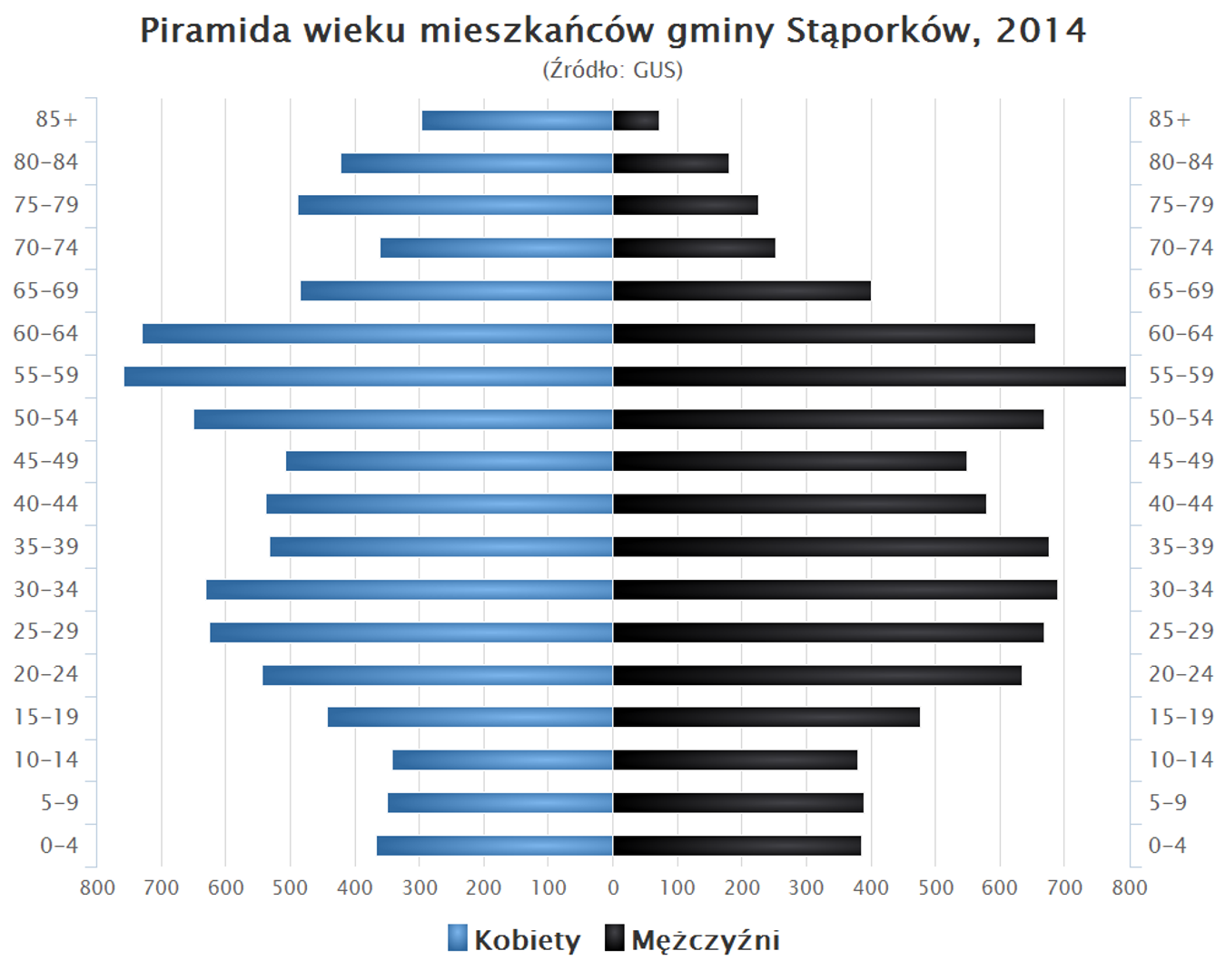
The urban-rural municipality of Stąporków, located in the Świętokrzyskie Voivodeship, in the Końskie County, was established in 1973 and covers an area of 231.41 km², of which 31% is agricultural land and 62% is forest land. In 2012, the municipality was inhabited by 18,066 people. Within its territory lies a subzone of the Starachowice Special Economic Zone, and the town of Stąporków is the seat of the municipality. The municipality is home to two nature reserves and the highest peak, Hucisko, with an elevation of 374 meters above sea level. The municipality comprises numerous villages, including Adamek, Bień, Czarna, Niekłań Wielki, Odrowąż, Hucisko, and many others. The area features numerous monuments, such as manor houses, churches, memorials, and historic buildings, for example, the monument to the Gut family murdered by the Nazis and the hundred-year-old PKP railway station in Stąporków. Important sites also include sanctuaries and churches, such as the church in Niekłań Wielki and the chapel in Odrowąż. The municipality has a rich history, being part of the region for centuries, and its administrative structure has changed as a result of reforms. In the past, Stąporków faced administrative challenges related to territorial reorganization. The municipality is also industrially developed, with facilities such as a paint factory, a gasworks, and a foundry. The area is also known for its sports activities, with local football clubs like MKS Stąporków. Among interesting facts, there is a monument in Wielka Wieś commemorating a fallen partisan commander, as well as the "Hubal" oak in Furmanów, which is over 150 years old. It is also worth mentioning that the municipality has neighboring municipalities, such as Bliżyn, Chlewiska, and Końskie, which form its local surroundings. The Stąporków municipality is a place of rich nature, history, and culture, preserving its uniqueness through a diversity of monuments and traditions.
Location
2026 Wizytor | All Rights Reserved

