Kłobuck County
7.62
Overview
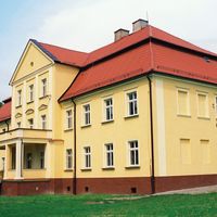
Kłobuck County, located in the northern part of the Silesian Voivodeship, was established in 1952 and re-established in 1999 as a result of administrative reform. Its capital is Kłobuck, whose origins date back to the 9th century, with the first written records from 1262. In the Middle Ages, Kłobuck gained importance due to its location on the trade route connecting Silesia with Greater Poland, which fostered the development of butchery and local agriculture. Its history was also shaped by visits from King Władysław II Jagiełło and the activities of Jan Długosz. In the 17th century, Kłobuck became a starostwo, and after the Second Partition of Poland, it was incorporated into state-owned estates, later becoming part of various administrations, including German administration during World War II. After the war, administrative boundaries changed, and in 1975 the county was abolished but was reinstated in 1999 as an association of 7 municipalities and 2 towns. Kłobuck County prioritizes nature conservation, with landscape parks and numerous reserves established within its borders, including Bukowa Góra and Dębowa Góra. In terms of infrastructure, the county is well-connected thanks to the A1 motorway and several national and regional roads, ensuring good regional accessibility. In recent years, the population has remained stable at around 84,000, reflecting the region's demographic stability. Cultural events in Kłobuck and Krzepice contribute to the social integration of residents. The county's architecture, though not overly developed, reflects its rich history and the changing influences and lifestyles of the local community. Interestingly, despite its small size, Kłobuck County has a fascinating and complex history that showcases its development over the centuries and its significance in the region.
Location
State
Silesian Voivodeship
Country


2026 Wizytor | All Rights Reserved