Strzegom Hills
7.59
Overview
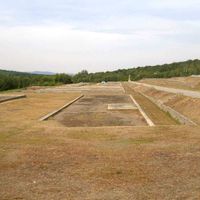
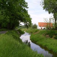
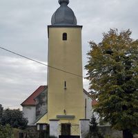
The Strzegom Hills, forming a mesoregion of the Sudeten Foreland, consist of four parts: the Jaroszów Hills, Rogoźnica Hills, Gniewków Hills, and the central and southern Strzegom Hills. They are characterized by a unique microclimate, particularly evident on Krzyżowa Mountain, which is covered with thermophilic vegetation. The hills are influenced by foehn winds and masses of humid air, which promote summer rainfall and have a beneficial effect on agriculture. The hills have a rich history, dating back to a pre-Slavic stronghold from around 500 BCE, which was destroyed during a Scythian invasion. Archaeological discoveries indicate the presence of the Lusatian culture, and during the Roman period, the region was an important trading point. In the 9th century, a defensive stronghold was built on Swarna Mountain, and later, in the 10th century, a castellany was established on Bazaltowa Mountain to protect the surrounding trading settlement. The hills also witnessed events from the Silesian Wars, including the Battle of Dobromierz in 1745. Geologically, the hills are composed mainly of granites and basalts, with ravines and peaks reaching up to 360 meters above sea level. The landscape is undulating and sparsely forested, dominated by cultivated fields and meadows. Although the area is urbanized, it features numerous quarries used for the extraction of granite and basalt. The Strzegom Hills are part of the Oder River basin, and their waters flow into the Baltic Sea basin. Thus, the region is not only a place of natural significance but also cultural importance, full of historical traces and architectural monuments.
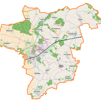
Location


2026 Wizytor | All Rights Reserved