Wilda
6.69
Overview
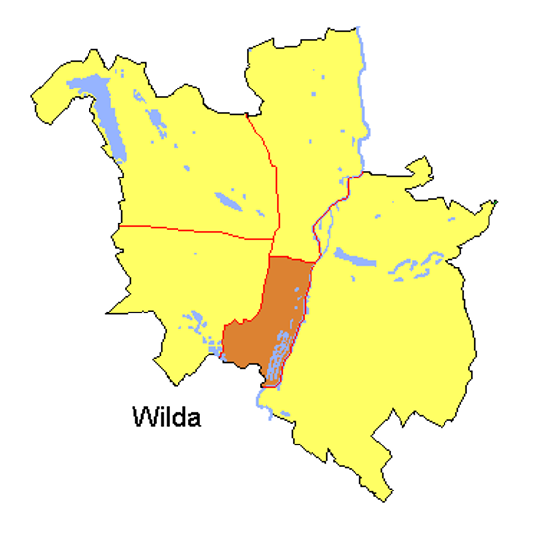
Wilda was a former administrative district of Poznań that existed from 1954 to 1990, covering the south-central part of the city with an area of 14.45 km², which constituted 5.5% of Poznań's total area. After the abolition of the districts in 1990, the areas of the former districts, including Wilda, were assigned to five delegations of the Poznań City Hall, with the Wilda delegation headquartered at 45 Wierzbięcice Street. In 2011, Wilda had a population of 60,021. The district was established as a result of an administrative reform when the Government Presidium decided to create five large districts in Poznań. In 1984, this division was confirmed by the Council of Ministers. The boundaries of Wilda are marked by, among others, the Warta River and a network of railway tracks, giving the district a distinct geographical character. Within Wilda, smaller topographic units such as Dębiec, Dębina, and Świerczewo stand out, indicating the diversity of local architecture and the character of these areas. From an architectural perspective, Wilda is diverse, featuring typical Poznań tenement houses, residential buildings, and public utility structures that reflect the history of the area. Wilda was also a hub of vibrant cultural life, hosting various social and artistic events, enriching this part of Poznań with local traditions and communities. Interestingly, the district’s boundaries not only define the residential area but also serve as a natural space for the development of local initiatives and organizations. It is also worth noting that the history of Wilda is linked to the dynamic urban changes that took place in Poznań in the second half of the 20th century.
Location
Tickets
Powered by GetYourGuide


2026 Wizytor | All Rights Reserved