Bilgoraj Plain
6.63
Overview
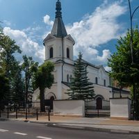
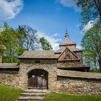
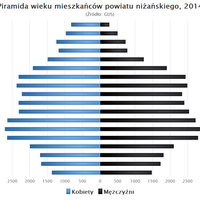
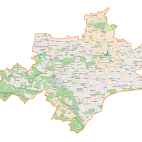
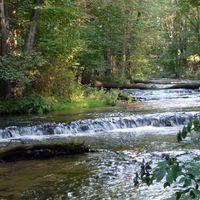
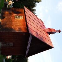
The Bilgoraj Plain is a geographical mesoregion located in southeastern Poland, forming part of the Sandomierz Basin. It stretches from the Vistula River in a southeastern direction between the Roztocze range and the lower course of the San River, with its boundaries marked by the valleys of the Sanna and Tanew rivers. The region reaches elevations ranging from 220 to 280 meters above sea level, sloping westward to below 150 meters above sea level. Formed from Quaternary sands and moraine clays, the area is characterized by low-quality agricultural soils, resulting in the dominance of pine forests, which are part of the Solska Wilderness. This has led to an alternative name for the region – the Forest Plain. Notable features also include local forested dunes and numerous fish farming ponds, which add diversity to the landscape. The mesoregion lies on the border between the Lublin and Podkarpackie voivodeships, encompassing six counties. Within the Bilgoraj Plain, there are four towns: Bilgoraj, Janów Lubelski, Modliborzyce, and Zaklików, as well as a number of smaller settlements such as Aleksandrów and Harasiuki. The region is known for its rich history related to settlement and folk culture, reflected in local traditions, crafts, and architecture. The architectural infrastructure includes both historic churches and residential buildings that capture the distinctive style of the region. Visitors are also impressed by numerous folk cultural events showcasing local traditions and customs preserved by the inhabitants. The natural landscape features and rich flora and fauna further attract nature lovers and tourists. Thus, the Bilgoraj Plain is a region that combines architectural, cultural, and natural values, making it an interesting destination for tourists and history enthusiasts alike.
Location


2026 Wizytor | All Rights Reserved