Mount Calvary
7.06
Overview
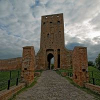
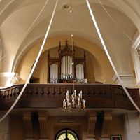
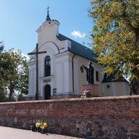
Góra Kalwaria is an urban-rural municipality located in the central part of the Masovian Voivodeship, approximately 35 kilometers from Warsaw. The seat of the municipality, Góra Kalwaria, is a town with a rich history and cultural significance. In the past, the municipality was known as Kąty until 1954. Góra Kalwaria is renowned for its architectural treasures, including a monumental monastery that is part of the Calvary architectural complex. Also unique are the numerous chapels and Stations of the Cross, which attract pilgrims and tourists. The municipality is surrounded by picturesque landscapes, with the Vistula River to the east forming a natural border with the municipalities of the Otwock County. Within its boundaries, there are agricultural lands (61% of the area) and forested areas (19%), giving the municipality a characteristic rural atmosphere. Demographic data shows that in 2017, the municipality had 26,579 inhabitants, indicating stable population growth. Among the 42 localities within the municipality are places such as Czersk, Kąty, Brześce, and Łubna. Góra Kalwaria, being a transportation hub, has a well-developed transport infrastructure, which ensures convenient connections to Warsaw and other centers. An interesting fact is that between 1975 and 1998, the municipality was part of the Warsaw Voivodeship. Local media, such as "Kurier Południowy" and the portal powiat-piaseczynski.info, provide residents with information about cultural and sporting events in the region, facilitating the integration of the local community. The Góra Kalwaria municipality combines tradition, culture, and nature, making it an interesting place to live and visit.
Location


2026 Wizytor | All Rights Reserved