Krzepice Depression
6.66
Overview
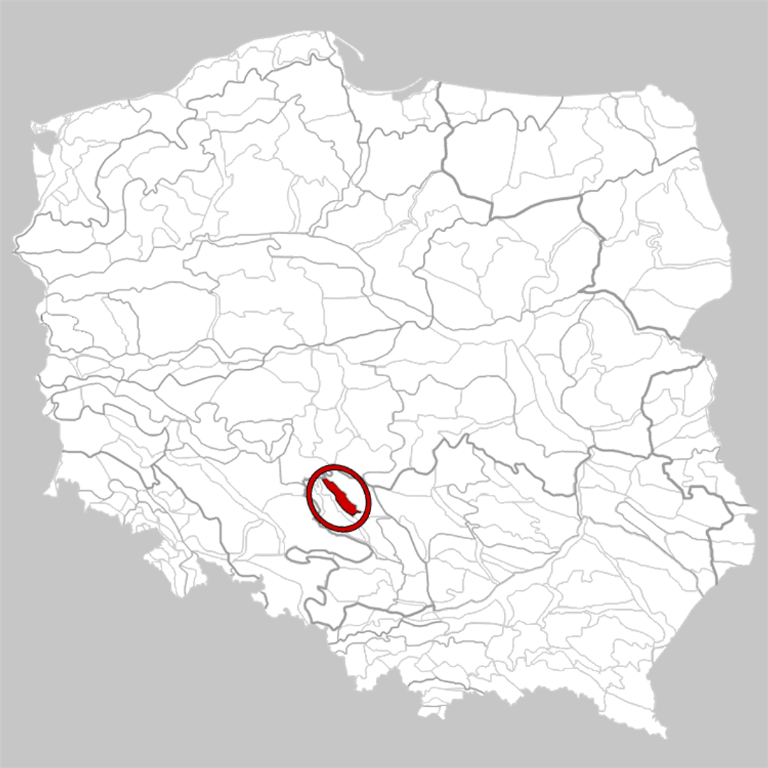
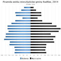
The Krzepice Depression (341.26) is a physiographic mesoregion in southern Poland, located in the north-central part of the Woźnicko-Wieluńska Upland. The region has the shape of an elongated belt, stretching in a northwest-southeast direction, and borders the Herby Escarpment, the Wieluńska Upland, and the Wieruszowska Plateau. The boundaries of the region include parts of the Silesian, Opole, and Łódź voivodeships, and its name comes from the town of Krzepice, which is the main urban center. The area is characterized by a thick layer of Quaternary clays and sands, which form small moraine hills and kame ridges, giving it a distinctive landscape. Despite its agricultural character, the region stands out with its relatively dense development and numerous towns with rich histories. The northern part is dominated by agricultural land of classes 4 and 5 suitability, while the southern part mainly consists of classes 5 and 6 soils, which favors agricultural development. The terrain reaches heights ranging from 220 to 300 meters above sea level, and the main watercourse in the region is the Pankówka River. The mesoregion also includes other towns, such as Kłobuck, which lies on the border with the Wieluńska Upland, as well as the municipalities of Mokrsko, Praszka, Rudniki, Radłów, Lipie, Krzepice, Przystajń, Panki, Opatów, Wręczyca Wielka, and Kłobuck. It is worth emphasizing that the Krzepice Depression also has interesting cultural and architectural aspects related to local folklore and agricultural traditions, making it an interesting place on the map of Poland. The region not only attracts nature lovers but also offers rich historical resources worth exploring.
Location
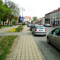
You can also find here:


2026 Wizytor | All Rights Reserved