Lowering of the Liswarta
6.63
Overview
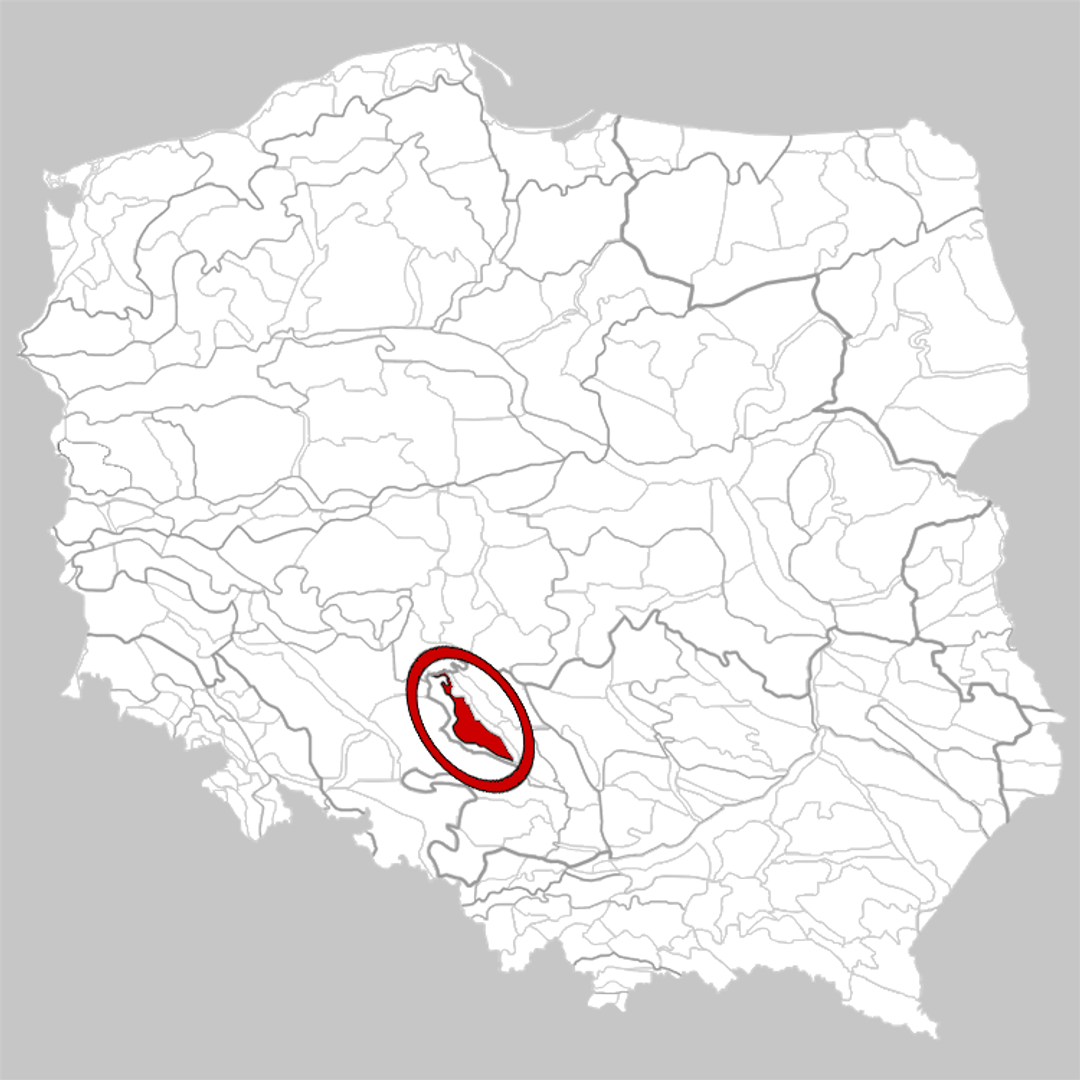
The Liswarta Depression (341.22), also known as the Liswarta-Prosna Depression, is a physiographic mesoregion located in southern Poland, forming the western part of the Woźnicko-Wieluńska Upland. The region stretches in the shape of an elongated belt oriented northwest–southeast, bordered by the Woźniki Escarpment to the west and the Herby Escarpment to the east. The depression lies on the border of the Silesian and Opole Voivodeships and takes its name from the Liswarta and Prosna rivers, which drain the area. It is characterized by extensive forest cover and terrain formed from weakly resistant rocks of the Upper Triassic and Lower Jurassic periods, with numerous nature reserves located in its central part. The region has limited agricultural land, primarily in the western part, where brown and rusty soils are found. The main urban centers of the region are Praszka and Gorzów Śląski, as well as villages such as Herby and Boronów. The Liswarta Depression includes the territories of the municipalities of Praszka, Gorzów Śląski, Kluczbork, Olesno, Radłów, Ciasna, Przystajń, Pawonków, Kochanowice, Herby, Blachownia, Boronów, Konopiska, Starcza, and Woźniki. An interesting feature is the region’s rich flora and fauna, which attract nature enthusiasts and tourists. The Liswarta Depression, through its natural assets and cultural elements, reflects local traditions and architectural heritage, and plays a significant role in preserving Poland's natural legacy.
Location


2026 Wizytor | All Rights Reserved