Krzeszów Trough
6.58
Overview
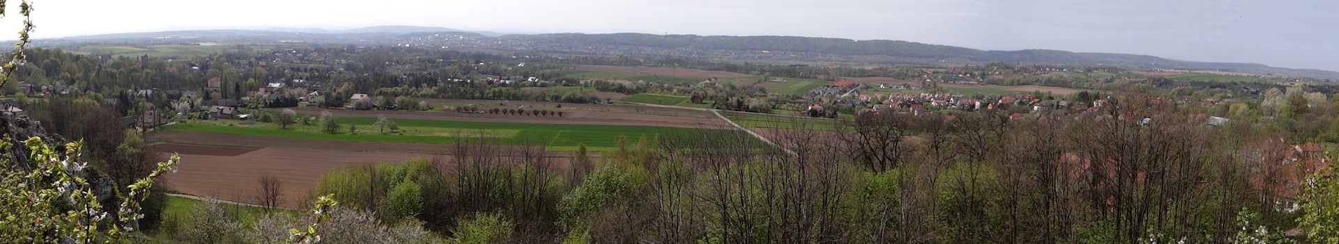
The Krzeszowice Trough is a physiographic mesoregion located in southern Poland, stretching over 30 km in length and covering an area of 225 km². It runs latitudinally between Kraków and Trzebinia, forming part of the Kraków-Częstochowa Upland. It borders the Olkusz Upland to the north and the Tenczynek Ridge to the south. Geologically, the trough is a Tertiary tectonic basin filled with Miocene sediments, with its floor situated at an altitude of 220–310 meters above sea level.
The trough is drained by the Rudawa River, which is known as Krzeszówka in its middle section and Dulówka in its upper reaches. The western part of the trough is fed by the Chechło River, which originates from the peat bogs of the Dulowska Forest. The Krzeszowice Trough is primarily used for agriculture, and its major settlements include Trzebinia, Młoszowa, Dulowa, Wola Filipowska, Krzeszowice, Zabierzów, and Rudawa.
Historically, the Krzeszowice Trough served as an important communication route, functioning as a historic trail connecting Silesia with Kraków. Today, it remains a key transportation corridor, with the railway line 133 (Kraków–Katowice), national road 79, and the A4 motorway passing through the region. Rich in natural and historical values, the area is attractive both for tourism and cultural exploration. Its significance in terms of transport and agriculture continues to shape the local community.
Location
You can also find here:

Zabierzów
7.69
Krzeszowice Deanery

Chrzanów
7.21
Trzebinia
7.21
Krzeszowice Deanery
Trzebinia
7.18
Krzeszowice Deanery
Krzeszowice
7.18
Krzeszowice Deanery

The Prochownia Manor Complex in Nawojowa Góra
7.04
Krzeszowice Deanery

Manor with a park complex in Karniowice
6.87
Krzeszowice Deanery

All Saints' Church in Rudawa
6.7
Krzeszowice Deanery
Rudawa
6.67
Krzeszowice Deanery

Great Village
6.66
Krzeszowice Deanery
2026 Wizytor | All Rights Reserved